How we spent our morning. Photograph by my son.
Category: travels
Marcus Garvey and Claude McKay in Jamaica
So cool to be sitting here in Jamaica reading about Marcus Garvey’s Black Nationalism and Pan-Africanism (which found their way into the Rastafarian faith) and about Claude McKay who traveled to the Soviet Union in 1922 and articulated a revisionist approach to Marxism by focusing on race and slavery. Both men were born in Jamaica. Robin D. G. Kelley’s book “Freedom Dreams: The Black Radical Imagination” is eye-opening, encyclopedic in its scope, fascinating.
Off to Montego Bay
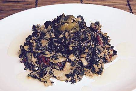
This morning, before we left Port Antonio, Marlene made this terrific Jamaican breakfast for us: callaloo with saltfish and freshly fried Johnny cakes 🙂
Blue Mountains, Jamaica
Today we took a trip to the top of the Blue Mountains and then biked all the way down to thunderous waterfalls. The Blue Mountains, clothed in lush green trees and shiny tropical plants, are named after the soft mist that crowns them permanently.
These majestic mountains, Jamaica’s longest range which includes its highest peak, remain relatively untouched on account of the narrow, winding roads that few are bold enough to navigate. Yet they are studded with tiny yellow and orange houses, folded neatly into the greenery, with what must be vertiginous views.
On our way to the top, we passed through Charles Town and I saw a sign for the Maroon Museum. Jamaican Maroons are the descendants of African slaves who escaped and established free communities up in the mountains. Jamaican slaves revolted and fled with such frequency that the British were forced to free them in order save their sugar business from constant disruptions. “The forests offered the Maroons everything they needed for their survival. They developed strong spiritual connections with the mountains, still manifest through the intangible cultural legacy of religious rites, traditional medicine and dances.”
We were shown a house where Obeah is still practiced, a belief system similar to Haiti’s Voodoo. It has been criminalized by law for hundreds of years as the Church considers it black magic. However, many Jamaicans are trying to get these anachronistic laws repealed. They see them as a throwback to the country’s colonial past.
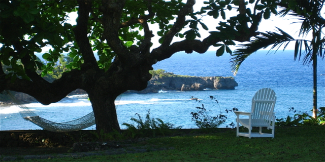
After a busy day, we were lucky to come home to delicious beef curry, vegetable rice, potatoes and plantains all prepared for us by the lovely Marlene. Port Antonio has been full of charm and comfort. Tomorrow we’re off to Montego Bay.
at goblin hill, port antonio
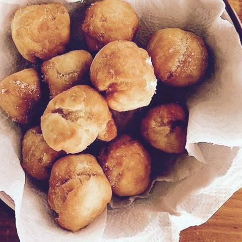
heavy rain showers this morning, quickly followed by warm, breezy weather. gorgeous views from our deck. spent some time at san san beach. had jamaican patties, made from scratch by our wonderful cook. now looking forward to homemade roast chicken, rice and beans and fried plantains for dinner 🙂
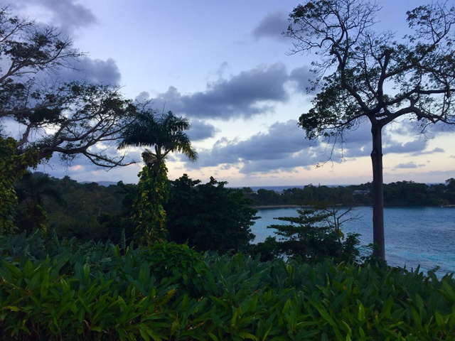
First sunset in Port Antonio, Jamaica
Christmas two years ago
Christmas break in Paris, two years ago, with Stephanie Nic Cárthaigh, Raymond Deane and Renate Debrun 🙂

Caught in a snow storm near Bismarck
We are here, close to Bismarck, caught in a snow storm and forced to spend the night at a Ramada Inn. We drove for more than 24 hours straight, thru Pennsylvania, Ohio, across Indiana to Chicago, followed by Wisconsin, and then through St. Paul, Minnesota, to North Dakota and beautiful sounding names like Absaraka and Spiritwood. We hadn’t gone far when we started getting calls and texts from friends telling us about how the US Army Corps of Engineers had denied an easement for the Dakota Access Pipeline, after 6 months of resistance by the Standing Rock Sioux and their allies. We decided to continue. After hundreds of years of broken promises, constant infringements on indigenous sovereignty, land and resources and the violation of some 500 treaties, it makes sense to take government concessions with a healthy dose of skepticism. The demarcation between what is supposed to be the US government and big business is not so clearcut anyway.
Sadly, we were welcomed by a huge snow storm as soon as we hit North Dakota.
The landscape was visually bewitching throughout. There were the frost-covered golden fields of Minnesota, where dark trees break up vast horizontal lines and stick out of the earth like candelabras feeling the magnetic pull of the sky. The snow in North Dakota was heavy, the roads sometimes barely plowed. Sue continued to drive, straining to see where we were going. I don’t know much about Harry Potter but Sue told me the scene reminded her of King’s Cross Station and its symbolism in the book, a crossroad between what is real and otherworldly, between life and death. Utility poles were somewhat visible and lent some interest to an otherwise blank canvas. Most lovely though, was the dried-up grass along the sides of the road. It tried to poke thru layers of snow, creating lines and lines of mysterious calligraphy. A brand new script just for us.
We are here. We cannot wait to go to Standing Rock tomorrow. The weather is supposed to be daunting – snow, wind and freezing temperatures. Our hotel is fully booked so we will have to make a move. Hope it’s to Oceti Sakowin camp.
on my way to standing rock!
am leaving for standing rock tomorrow along with rochester activist friends.
we will be driving straight to north dakota, for 23 hours, and hope to be there on monday dec 5, the day the camp is supposed to be forcibly broken up and evacuated. thousands of veterans plan on joining the camp on dec 4, in order to shield water protectors and their allies.
am taking beautiful verses from the quran with me, as this indigenous-led movement for clean water, respect for the earth and for the sanctity of life, is completely non-violent and deeply prayerful. hope to contribute however we can, support the camp against a possible shutdown, learn as much as possible from the standing rock sioux and other indigenous elders, and be back later in the week.
pls keep us in ur prayers and donate, support, help the movement in any way u can. more info here.
#NoDAPL #WaterIsLife #StandWithStandingRock
thanksgiving 2016
nov 23, 2016: in NC with family. saag gosht, beef biryani, aloo gosht, kheer – and we just barely got here!
nov 24, 2016: hanging out at chachu and khala’s brand new house in charlotte. so good to have all three of our puppies with us.
nov 26, 2016: with my sister in charlotte, NC.
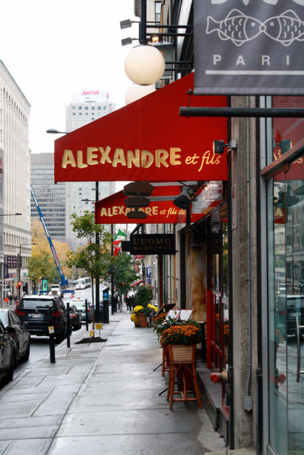
Montréal – Nov 2016
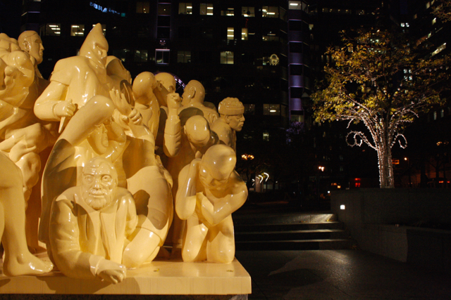
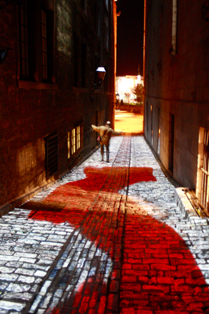
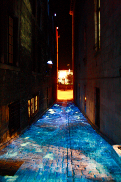
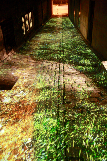
Cité Mémoire
One more thing that blew my mind was Cité Mémoire, a project by Michel Lemieux and Victor Pilon. For the next four years, Old Montreal’s building facades, cobblestone streets and trees will be lit with multimedia projections inspired by the history of the city. Each projection can be activated by anyone using a cellphone app. My favorite, by far, is an Algonquin creation myth which comes to life in a narrow, cobblestone alley off of St Paul. As the story is narrated on one’s phone, accompanied by rhythmic indigenous songs and music, the street fills with seawater churned by breaking waves, ocean foam, and schools of tiny fish. The projections are interactive. If one decides to wade into the water flowing under one’s feet, swaths of red are left behind before they merge back into the dancing water. Towards the end of the story, living and breathing algae and colorful vegetation seem to bloom into the alley. It’s breathtakingly beautiful.
Teaser – Cité Mémoire 2016 from Montréal en Histoires on Vimeo.
In Montreal!
The two flights to Montreal weren’t that great – tiny, shaky planes and lots of motion sickness and Dramamine for me. My hotel however is dope. Le Cantlie is situated in the middle of downtown, on Sherbrooke, right on the edge of McGill’s main campus.
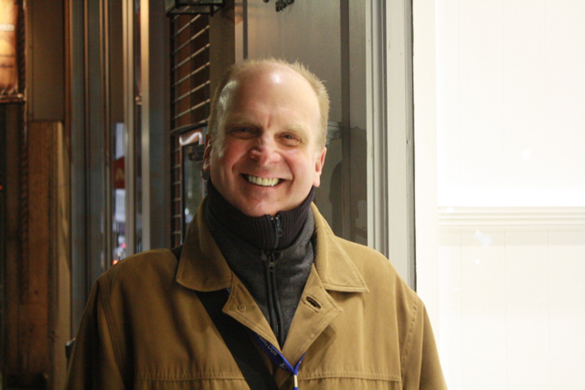
I checked in around 5:30pm and met Pierre, my guide, soon after. He explained the city’s layout: the St Lawrence river forms its southern most border, Old Montreal sits on top of it, followed by downtown, and then the mountains. The city is named after a three-headed hill called Mount Royal. Its old port was considered the gateway to America and it transformed Montreal into a thriving commercial hub.
My first impression, after having adjusted to the serious level of cold that’s already entrenched here, was how artistic the city is. Every quartier or neighborhood is designed by different architects and artists based on their own unique vision of what the financial or entertainment or cultural centers of the city should look like. From buildings and public art, to benches, streets lights and trash cans – everything’s designed meticulously around ideas of community usage and engagement and a cohesive aesthetic mission. For example, a side street that was used for truck deliveries, Ruelle des Fortifications, was converted into a glass-covered promenade in 1992. It now links several historical buildings that have been renovated, creating a beautiful indoor village.
After the Royal Bank left Old Montreal for downtown in 2010, its magnificent Tower, which used to be Canada’s tallest landmark at one point, was left sad and abandoned. Not for long. The opulence of the building was preserved (down to its teller windows, beautiful floor tiles, intricately carved gold doors and sparkly chandeliers) when it opened this year as Crew Collective & Café. The cafe is great but what I loved even more was how start-ups, entrepreneurs and artists can rent space at affordable rates in the same building, whether for an office or a small meeting room paid for by the hour. It’s all about community.
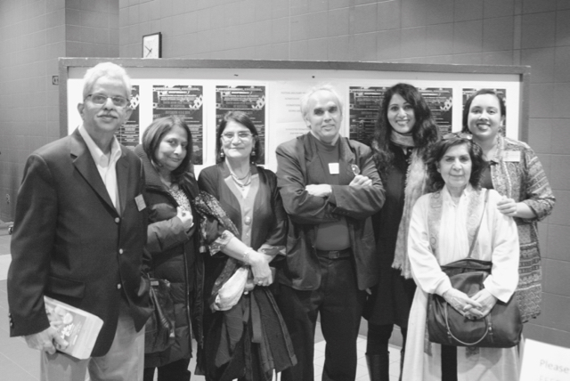
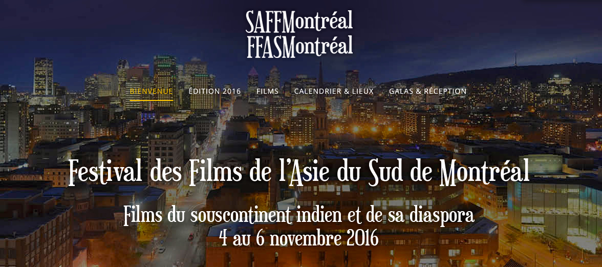
A Thin Wall selected by Montreal film festival!
A Thin Wall will be screened as part of the South Asian Film Festival of Montréal 2016 on November 5, at 12:00 pm, at Montreal’s Concordia University. I plan on traveling there for the Q&A. Montreal friends, hope you can make it!
my brother’s memories
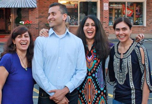
this past weekend, we went to visit my brother, his family, and my mom and dad. we made this trip to celebrate my multi-talented musician nephews at a concert. drums, bass, electric guitar, ukulele, vocals – u name it, they excel at it. hanging out with my brother was trippy, as always. it’s not just his bright sense of humor or his ability to weave hilarious, legendary stories out of almost nothing, it’s also that many of his memories of our common past complete and restore mine. he, and my sisters, complete my story, my sense of identity. it’s an amazing thing. like existing as some kind of impressionistic painting, spread across states and continents, illuminated point by point by the recollections of those we love. we forgot to take the mandatory selfie, so here’s an older picture from a few years ago. it’s an homage to my brother and sisters who are an indelible part of who i am.